Gathering Flow Data to Keep People Safe (UTRCA weekly, April 22, 2021)
April 22, 2021 – For more than 70 years, the UTRCA has been protecting people and property from natural hazards, such as flooding and erosion, and supporting safe development. To do this, we need detailed maps and models of flood plains and other natural hazards.
To keep these tools up to date, our Water Resource Technicians stay busy year round with fieldwork to collect watercourse data. One current focus is on updating hazard mapping in areas of the watershed that are most susceptible to flooding or where there is significant development pressure. We map and model flood plains using detailed calculations, including how much water comes off the landscape (hydrology) and how water moves through the watercourse (hydraulics).

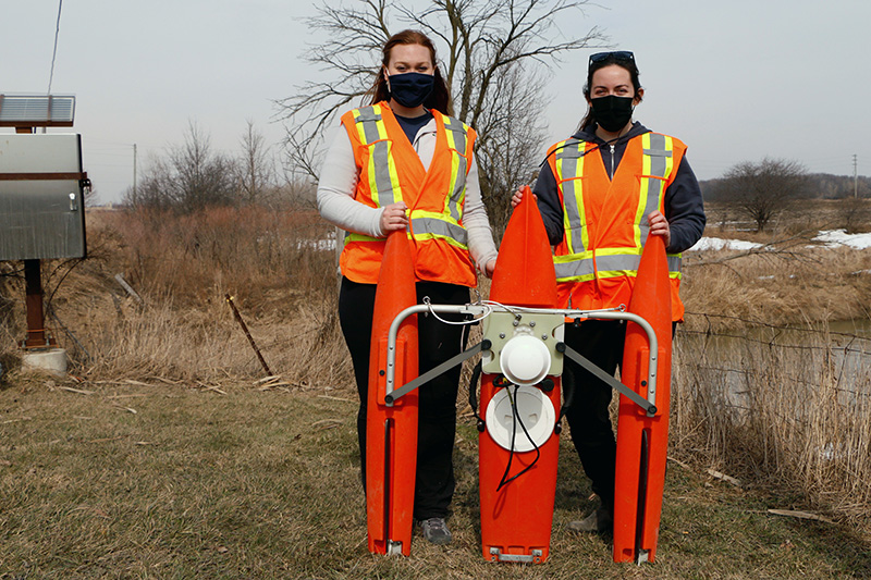
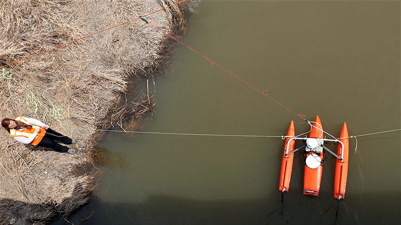
Our technicians make site visits to the various stream gauge stations (hydrometric stations) at different times of the year, to capture a range of stream flows at each station. They use an Acoustic Doppler Current Profiler (ADCP) to measure the water’s velocity. The velocity is used to calculate flow rate (in cubic metres/second), which is then related to the depth of water in the stream.
This data is used for flood forecasting, for statistical analyses or likelihood of flood flows, and to aid in determining where the flood plain is located and, from that information, where it is safer or less safe to build.
This video explains more about their work and the ADCP.
We spoke with Beth Wrona, Water Resource Technician, to learn more about her work.
1. What does a typical day in the field look like?
One of the reasons that I really like this job is that there isn’t really a “typical” day in the field. Every day is different. One day we might be out collecting high flow measurements during a flooding event, and the next we’ll be troubleshooting an equipment failure or setting up a new monitoring station. The UTRCA has a large monitoring network so I regularly work all over the watershed.
2. Is the information you collect available immediately? Or does it require some interpretation?
Station data are transferred hourly via phone modem or satellite to our central computer database, where any corrections or transformations are automatically applied.
Provisional surface water and meteorological data are available in almost real-time to the public through our website.
3. How is this information used?
We use information from our monitoring network to support flood forecasting and management and low flow response activities, as well as day to day operations of water control structures like Fanshawe, Wildwood, and Pittock Dams. The public also use this information to make decisions on recreational activities like fishing and boating.
4. Has anything surprised you when collecting this information?
So far nothing has really surprised me in the data but I continue to be surprised by the number of wasps that make homes in our equipment enclosures!

Special thanks to the City of London and the Government of Canada’s National Disaster Mitigation Program for their funding support.
Find our more about flood and erosion hazard mapping and how the UTRCA works to keep people and property safe, while supporting safe development.
This work supports the UTRCA’s Environmental Target to reduce flood and erosion risk by updating flood models and hazard mapping for all UTRCA subwatersheds by 2020, then integrating climate change scenarios into the updated models and developing climate change adaptation strategies by 2030.

