What is Thundersnow?
Have you been wondering if there is a name for the snowy thunderstorms you've been seeing across the watershed? These wintery thunderstorms are called Thundersnow.
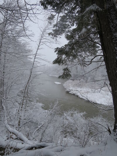
Late Friday, January 12, 2024 the Upper Thames watershed experienced Thundersnow as a result of a Texas low moving over the Great Lakes and into Southern Ontario. This storm included heavy snow, wind gusts, thunder, lightning, as well as approximately 15.88 mm of precipitation falling in London, 14.42mm near St. Marys, 4.40mm near Embro and 4.22mm in the Mitchell.
A Texas low is a low-pressure area that forms or intensifies over the Gulf of Mexico and moves Northeast (Wikipedia). Thundersnow, sometimes called White Lightning, is when a thunderstorm is accompanied by precipitation in the form of snow instead of rain. The thunder that is heard with this type of winter storm is a lot less dramatic than that of summer thunderstorms, due to the snow dampening and softening the sound of thunder.
Thundersnow is relatively rare and needs specific conditions to develop. Four things are needed to result in these rare storms, namely: moisture, lift, an unstable atmosphere temperature profile, and below freezing air in the cloud and near ground level (Schultz, David, James 2009). Due to Southern Ontario being surrounded by the Great Lakes it is more likely to have the ideal conditions to create thundersnow when the lakes are unfrozen and warmer than the surrounding air.
According to Ed Brotak, "There are several weather situations in which thundersnow storms can develop. Cold air moving across a warmer body of water can set up a lapse rate (the rate at which air temperature falls with increasing altitude) sufficiently steep to generate convection and while the added moisture from below can generate more precipitation. Such a setup often occurs around the Great Lakes in winter. The famous "lake effect" snow often has a convective nature, especially early in winter when the lakes are their warmest and cold polar or arctic air masses move in from the northwest. This usually occurs following the passage of a low-pressure area and its associated cold front. With the low to the northeast of the region, the cyclonic flow produces a westerly wind across the warm lake waters, the air near the surface is warmed and moistened" (Brotak, 2010).
This Phenomena needs perfect conditions to develop, which means there have been limited opportunities to study this unique weather event as opposed to other weather events we endure more frequently (Market, Patrick, Chris, Rebecca Dec. 2002). Over the past few winters the weather conditions in Southern Ontario have been ideal for experiencing this infrequent weather event which will only continue to aid in improving meteorologists understanding of thundersnow. Until a better understanding of these storms exists, we will simply have to watch the skies to appreciate this meteorological marvel.
Sources:
Schultz, David M., and R. James Vavrek. "An overview of thundersnow." Weather 64.10 (2009): 274-277.
Brotak, Ed. "Thundersnow." AeroSafety world 5 (2010).