Collecting Climate Data to Predict Water Level Conditions
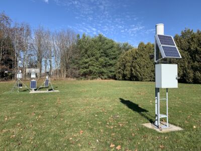
The Upper Thames River Conservation Authority’s (UTRCA) Water Information Management unit monitors many sources of climate and hydrometric (standardized water quantity and information) data in order to predict future water level conditions, including water levels, estimated discharge rates, rainfall rates and cumulative totals, snow depth and water equivalents (the amount of water required to consume the same amount of heat as a substance consumes for one degree rise in the temperature). The UTRCA maintains six climate stations as well as 21 rainfall rate precipitation gauges across the watershed.
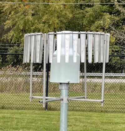
Culminative rainfall is collected in weighing gauges, which are large buckets that use weight-based technology to measure the amount and intensity of precipitation. Staff empty, clean and prepare the equipment each spring and fall to make sure it is functioning properly.
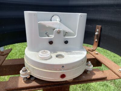
The rate of rainfall is measured with tipping buckets. Staff clean and calibrate them twice a year to ensure we are getting accurate data of how quickly rain is falling on the landscape. Tipping buckets funnel water into smaller buckets that tip from one side to the other as they fill. This flips a switch that counts how many times the bucket tips. This number is calibrated such that each tip is equivalent to 0.2 mm of rain. These gauges can also be used to estimate accumulated rain in non-winter months.
We also have other sensors at some of our stations that monitor wind speed, wind direction, snow depth, air temperature, relative humidity, atmospheric pressure as well as other parameters. All of this data helps us with flood forecasting and warning, low water responses, climate change monitoring in our watershed, and field work planning.