Oxford Natural Heritage Systems Study Update
Through a contract with the County of Oxford, the Upper Thames River Conservation Authority (UTRCA) is updating the Oxford Natural Heritage Systems Study using 2020 ortho-imagery (digital aerial photography). The previous study was completed in 2016 and used 2010 imagery.
The purpose of the study is to identify existing natural heritage systems in the county, as directed by the Provincial Policy Statement. Natural heritage refers to components of the natural environment that have historic, scientific, or social significance for the community and future generations.
It is important to update these studies every 5-10 years as the natural heritage system changes slightly over time as young woodlands mature, meadows develop on fallow land, and some features are removed.
The study is a science-based, modeling exercise using Geographic Information Systems (GIS) technology, ortho-imagery mapping, and a set of ecological criteria to determine significance or ecological importance. Digital aerial photography is becoming clearer and clearer. Overlaying older and newer imagery allows staff to map natural features and identify changes more accurately.
The study will include statistics on the vegetation loss, gain, and change between the 2010 and 2020 photography.
In partnership with County planning staff, an updated report will be produced as well as an updated digital mapping layer. The study is set to wrap up in early 2023, so that it can be used by the County of Oxford to inform planned updates to the natural heritage system mapping and related policies within its Official Plan.
Contact: Cathy Quinlan, Terrestrial Biologist and Terry Chapman, GIS Specialist
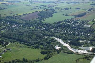
Woodland cover along the Thames River near Beachville