Other UTRCA Lands
In addition to conservation areas and tracts that are open to the public, the UTRCA protects more than 2,000 hectares of land that has no access or limited access for hunting only.
Wetlands
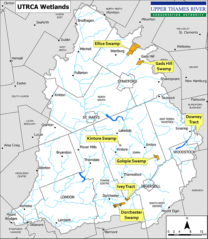
The UTRCA protects more than 1500 ha of wetland across the watershed. These natural properties are home to hundreds of species of plants and animals, some of them rare. These properties have outstanding natural heritage value and make significant contributions to surface water and groundwater protection, flood attenuation, and wildlife habitat, as well as carbon sequestration and storage. These properties have no managed/groomed trails or facilities and many of the sites are wet and very densely vegetated.
Some of the properties are listed below. Click on the links to learn a little about the wetlands, the habitat and species that are being protected, and other environmental benefits they provide. Hunting is permitted at these properties under the UTRCA’s hunting lottery system.

Flood Plain Lands (Scheme 43 Lands)
The UTRCA owns approximately 290 ha (717 acres) of flood plain lands throughout the watershed. The flood plain lands are mainly small parcels and are managed by the municipalities where they are located: London (172 ha), Mitchell/West Perth (26 ha), Woodstock (43 ha), Ingersoll (18 ha), and Dorchester/Thames Centre (34 ha).
Most of these lands were acquired between 1970 and 1990 under agreement between the UTRCA, participating municipalities, and the Province of Ontario. This three-party arrangement was called Scheme 43 and the Authority refers to these properties as Scheme 43 Lands. The cost of acquisition was split between the Province and the municipalities. The UTRCA retained ownership of the lands to protect the Province’s interest.
Agricultural Lands
Some UTRCA lands are leased for agriculture to local farmers. They are part of land holdings that were purchased for the flood control reservoirs. Many agricultural fields have been reforested, but some continue to be leased out to local farmers to provide revenue for the Authority’s operations. Staff have developed an agricultural plan for each field to ensure the land is farmed sustainably. Some properties are also used for agricultural demonstration or research purposes.

