UTRCA launches the Collaborative Water Data Viewer
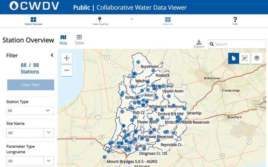
The Upper Thames River Conservation Authority (UTRCA) is excited to announce the launch of the Collaborative Water Data Viewer (CWDV). This interactive, open-data portal can be used to access real-time environmental monitoring data from UTRCA and our partners.
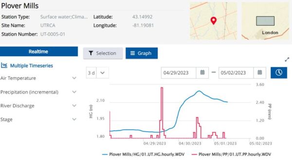
The UTRCA received funding for this project through Royal Bank of Canada’s Tech for Nature Grant, with the goal of enhancing data accessibility and integration. The CWDV allows users to view monitoring stations spatially, interact with the data in tables and graphs, and download the data in a variety of formats. Monitoring stations measure parameters such as water level, air temperature and precipitation. Users can filter the portal results or enter one of our custom pages that focus on specific areas of interest.
One of our current partnerships is through the Community Precipitation Monitoring Project which involves local community members utilizing the online Community Collaborative Rain, Hail and Snow Network (CoCoRaHS) platform to monitor precipitation throughout our watershed. Recorded precipitation values are brought into the CWDV through UTRCA’s data management network and can be analyzed alongside UTRCA’s climate data.
Another notable partnership is the Western Ontario Data Hub hosted by UTRCA. This network of 11 Conservation Authorities collectively manages their environmental data within a shared database system. Through this collaboration, the CWDV will provide an opportunity to enhance open-data solutions and accessibility for member Conservation Authorities. Future plans for the CWDV include growing the number of participating partners and expanding the environmental monitoring datasets available.
You can access the Collaborative Water Data Viewer directly from the links in this article or on the Thames River Flows and Other Information page on UTRCA’s website.
Contact: Laura Flynn, Water Management Data Specialist