2022 Upper Thames River Watershed Report Cards
Every five years, the UTRCA produces watershed report cards to report on local environmental conditions in each of the 28 subwatersheds within the upper Thames watershed. These reports summarize extensive environmental information, with the goal of guiding local environmental action and tracking environmental change.
Each report card grades surface water quality and forest conditions, summarizes watershed features, provides recommended actions for improvement, and highlights progress made over five years. The grading follows standardized Conservation Authority Watershed Report Card guidelines developed for watersheds across Ontario.
Explore the Watershed Report Cards!
Check out the Interactive Map and StoryMap

Copies of the entire report are available from the UTRCA. You can also view this summary of the Upper Thames River watershed report cards. To see information from Conservation Authorities across the province, go to Conservation Ontario’s website.
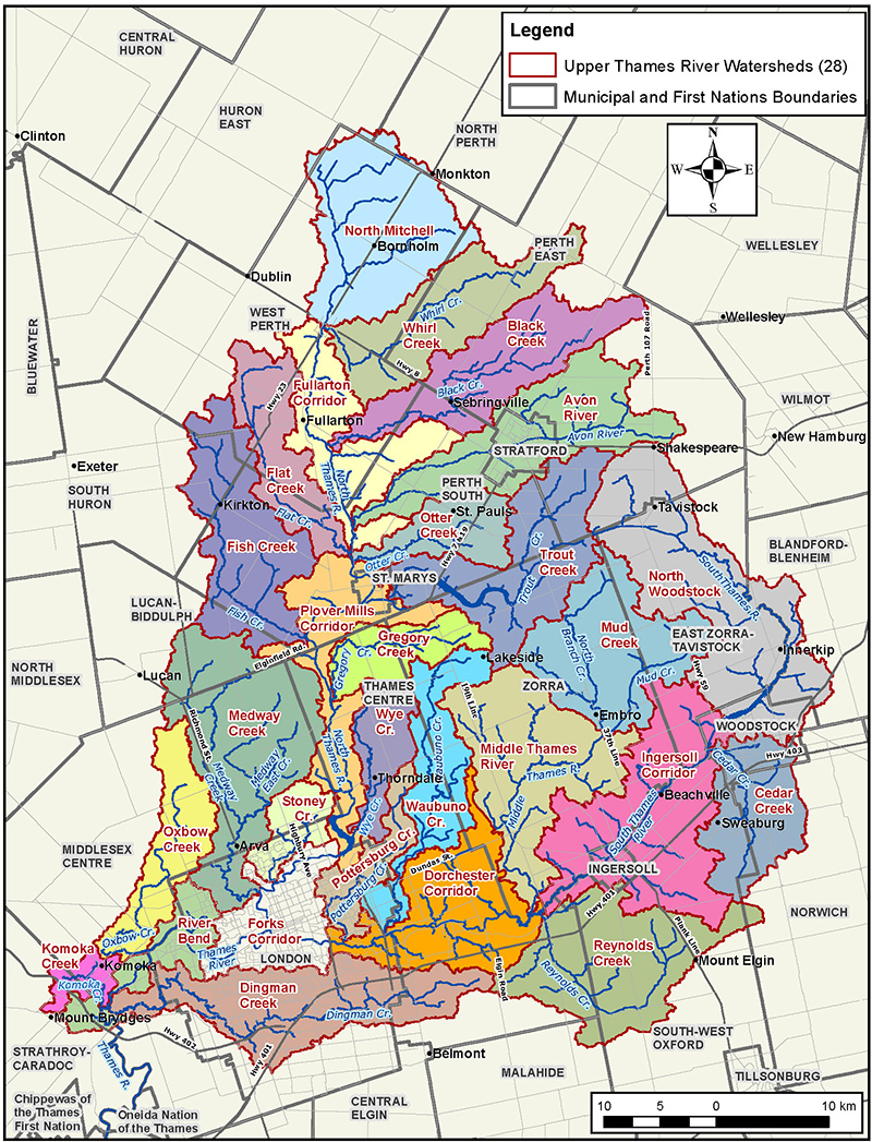
Find your local Watershed Report Card:
- Find your WATERSHED on the map and then in the navigation menu
- Find your MUNICIPALITY (listed below map) and click on your watershed

Municipalities & Watersheds
- Blandford-Blenheim
- East Zorra-Tavistock
- Huron East
- Ingersoll
- London
- Lucan-Biddulph
- Malahide
- Middlesex Centre
- North Perth
- Norwich
- Perth East
- Perth South
- South Huron
- South-West Oxford
- St. Marys
- Stratford
- Strathroy-Caradoc
- Thames Centre
- Wellesley
- West Perth
- Woodstock
- Zorra

