Snow Surveys in the UTRCA Watershed
UTRCA staff have manually surveyed accumulated snow across the Upper Thames River watershed for over 50 years. The data is collected as part of the provincial Snow Survey Program, which is a collaboration between Conservation Authorities, Ontario Power Generation and the Ministry of Natural Resources (MNR).
Snow measurements help quantify the amount of water available to melt during the winter or early spring. The UTRCA uses snow survey information to aid in flood forecasting and warning and reservoir management.
Sampling Sites
The UTRCA established eight snow survey locations in the 1950s. Over time, some sites were added and some were discontinued as property access changed. Currently, the UTRCA samples snow at 13 locations across the watershed, including seven locations that are at or very near to the original eight sites.
Considerations when selecting a site include access, vegetation, topography and exposure to wind. The best sampling sites are relatively flat, well-drained, grassy areas that are protected from the wind and located on public property, as described in the MNR Snow Survey Guide (1985).


Sampling
Snow surveys are conducted in general accordance with the MNR Snow Survey Guide (1985), with Mount Rose snow equipment provided by MNR.
Measurements are made twice a month during the winter, as near to the 1st and 15th of each month as possible.
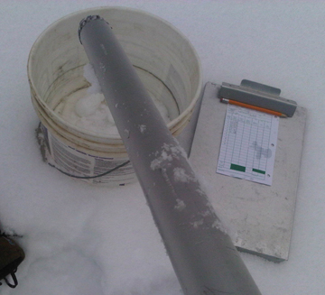
Snow depth is measured with a calibrated snow core tube with a written imperial scale along the outside of the tube. Snow depth is measured and recorded at 10 locations across a site. From the 10 snow depth measurements, an average snow depth is calculated and recorded for each site (inches).

Snow-water equivalent is calculated to determine the amount of water in the snow pack. At each depth measurement, a snow core is collected within the tube and emptied into a common bucket to be weighed at the end of the 10 measurements. The snow tube is calibrated so that 1 ounce of snow equals 1 inch of water. Dividing the total weight of the 10 snow cores by 10 produces the average snow weight for that site (ounces), which is then converted to mm and represents the snow-water equivalent.
Other observations collected at each site include date, time, weather conditions, temperature, snow drift information, coverage and ground conditions.
Maps *
Click on these links to see snow depth and snow-water equivalent maps from December 15, 2010. The maps are created from data collected by UTRCA as well as neighbouring authorities: Ausable Bayfield, St. Clair Region, Kettle Creek, Long Point Region, Lower Thames Valley, Grand River and Maitland Valley.
The maps are created using a component of Arcview’s Statistical Analysis Package that uses the known data points to create isoline depictions estimating conditions between points. Similar to a contour map, snow depths or amounts of snow-water equivalent are estimated and graphed according to the contour intervals identified in the legend (mm). Trace amounts of snow indicate immeasurable but present snow coverage.

Considerations
Please note that the actual conditions in between snow survey locations may be significantly different than is indicated on the map. Reasons for this include:
- The relatively few snow survey measurement points on which to base estimations;
- The inherent spatial variability of snow precipitation and subsequent spatial variability of snow melting and redistribution by wind;
- The contours displayed on the maps are a result of the statistical software estimations;
- Inherent error in snow survey sampling methodology and timing at the site level.
In addition, please note that snow conditions can change rapidly and the snow survey measurements are only valid at the time of the measurement. Due to the manual nature of the snow survey sampling, coupled with multiple organizational management and variable winter conditions, measurements do not occur at the same time of day and sometimes do not occur on the same day.
* Users of the UTRCA’s data are cautioned to consider the provisional nature of the information before using it for any purpose. The UTRCA assumes no responsibility for the correctness of the information contained in this website nor liability to any user of such information, regardless of the purpose.

