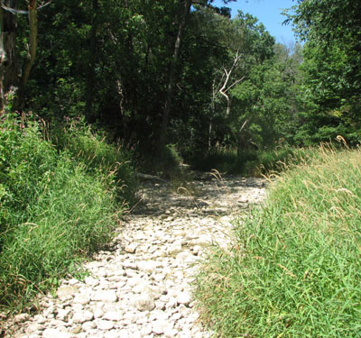
Low Water Response
Periods of drought, when prolonged dry weather results in low water levels, have been relatively uncommon in Ontario. However, recent studies on changing weather patterns indicate that low water levels may become more common, at the same time as the demand for water steadily increases.
Under the Province’s Ontario Low Water Response strategy, local water users and managers establish Water Response Teams (WRT) in areas experiencing low water conditions so the local community can carry out actions to reduce and better manage water use.

The WRT in the upper Thames River watershed includes representatives from municipalities, agriculture, golf courses, aggregate producers, and the Ministries of the Environment, Conservation and Parks, Natural Resources and Forestry (MNRF), and Agriculture, Food and Rural Affairs, as well as the UTRCA.
The Conservation Authority and the MNRF monitor precipitation, stream flow and water levels in order to recognize and measure the severity of a low water condition. The local Water Response Team decides on appropriate measures and conservation actions, promoting the response plans and requesting all water users share the limited water. Municipal water use bylaws may be enacted at any stage of low water.
Ontario Low Water Response Levels*:
Level 1 Bulletins

Issued when stream flows are approximately 70% of their normal flow or the watershed’s precipitation for one month falls below 80% of average. Level 1 bulletins also report general conditions of the watershed, and ask the public to voluntarily reduce water consumption by 10%.
Level 2 Bulletins

Issued when stream flows are approximately 50% of their normal summer flow or the watershed’s precipitation for one month falls below 60% of average. Level 2 bulletins also report specific drought related concerns and ask all holders of Permits to Take Water and the general public to voluntarily reduce water consumption by 20%. Municipalities may implement or increase restrictions on non-essential water use.
Level 3 Bulletins

Issued when stream flows are approximately 30% of their normal summer flow or the watershed’s precipitation for one month falls below 40% of average. Level 3 bulletins also report the potential for significant harm to the ecosystem and economic harm to water takers. Municipalities may implement or increase restrictions on non-essential water use.
*The Ontario Low Water Response report was developed by the Province, municipalities and Conservation Authorities. The report defines drought and low water and describes the means of measuring and quantifying drought and the conditions leading up to it. Three drought condition levels are described: Level I (warning), Level II (conservation) and Level III (restrictions). The report also identifies precipitation and streamflow indicators used to determine the level for watersheds.

