The Flood of ’37
The maps below, from the Upper Thames Valley Conservation Report, 1952 (Department of Planning and Development), show the extent of the flooding in 1937 in London, Woodstock, Ingersoll, St. Marys and Mitchell.
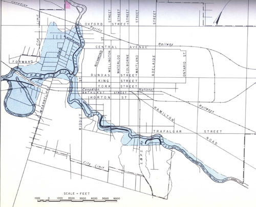
City of London (Forks of the Thames – North and South)
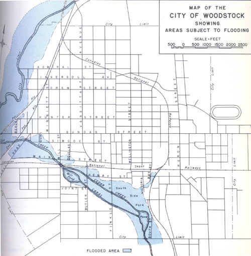
City of Woodstock (South Thames River at Cedar Creek)
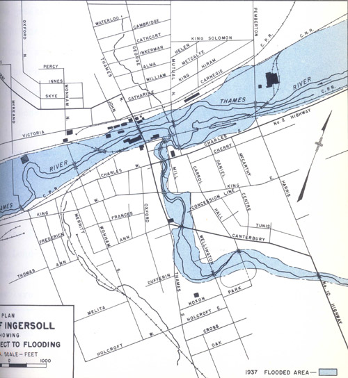
Town of Ingersoll (South Thames River at Halls Creek)
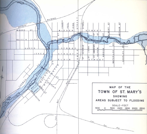
Town of St. Marys (North Thames River at Trout Creek)
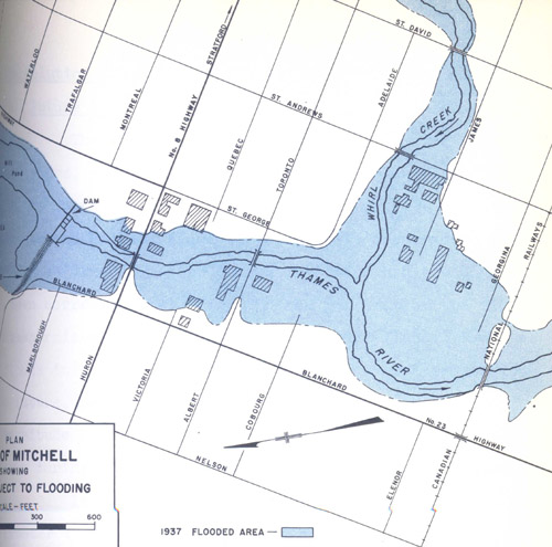
Town of Mitchell (North Thames River at Whirl Creek)