The West London Dyke
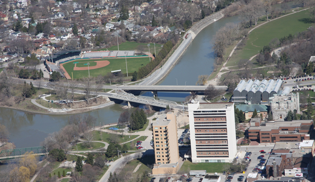
West London Dyke, April 2013
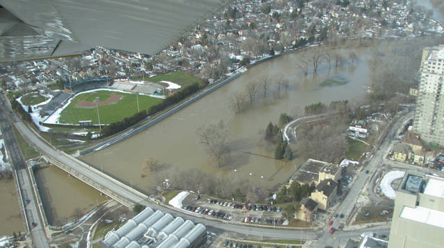
West London Dyke, February 2009
Construction of the West London Dyke, the first of the City’s seven dykes to be built, began in the late 1880s. By the early 1900s, the dyke had been reinforced, extended and raised at least twice. The flood of April 1937 overtopped the reinforcements, though, and flooded the communities behind the dyke. In 1947 some overtopping of the dyke on the North Branch section required evacuations, although flooding was not nearly as deep as in 1937.
Today, the West London Dyke is 2374 metres long, running along the west bank of the North Thames River from Oxford Street to the Forks of the Thames, and then along the west bank of the main Thames River to the west side of the Wharncliffe Road Bridge. The City of London owns the dyke and the UTRCA undertakes major maintenance activities. The dyke is the focus of major ongoing rehabilitation efforts.

West London Dyke, April 1947 Flood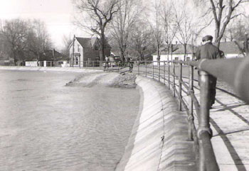
West London Dyke, April 1947 Flood
The dyke protects approximately 1200 structures to just less than the “Regulatory Flood” level, which is based on the Flood of April 1937. The construction of flood control dams upstream of London after the formation of the UTRCA in 1947 has provided considerable additional protection for the West London area.
It is estimated that upstream flood control operations have prevented flooding over the dyke on up to eight occasions, including September 1997, July 2000, and February 2018. Without these upstream flood control works, the flooding in 2000 and 2018 may have overtopped the dyke on the North Branch just as it did in 1937.
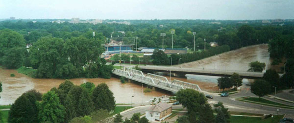
Forks of the Thames and the West London Dyke, July 2000 Flood